Connect CR Alliant Energy Lightline Pedestrian Bridge Bathymetric Survey
Cedar Rapids, Iowa
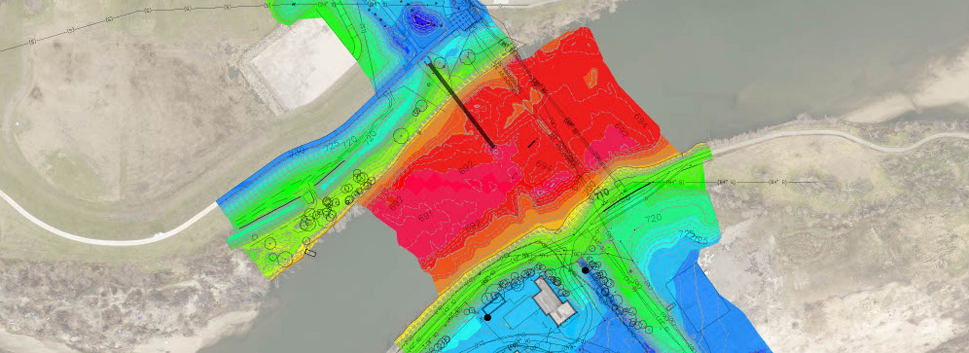
The Connect CR project seeks to improve urban recreational opportunities in downtown Cedar Rapids by adding enhancements to Cedar Lake. The addition of the Alliant Energy Lightline Bridge is part of his overall improvement project. Shoemaker & Haaland provided surveying services that were used to design the new Alliant Energy Lightline Bridge spanning the Cedar River and connecting the north section of the Cedar River Trail to the south section of the Cedar River Trail near the recreational area of Mount Trashmore.
A topographic survey of the north and south sides of the Cedar River was performed. This survey included setting vertical and horizontal control points and mapping all existing features, contours, and utilities. A bathymetric survey was performed to determine the bottom depth of the Cedar River to create a 3D model of the river bottom. An echo sounder integrated with RTK GPS equipment was used.
Project Scope: Topographic Survey, Horizontal & Vertical Controls, Bathymetric Survey, Utility Mapping & Locates, and Base Mapping
